Search Gallery:


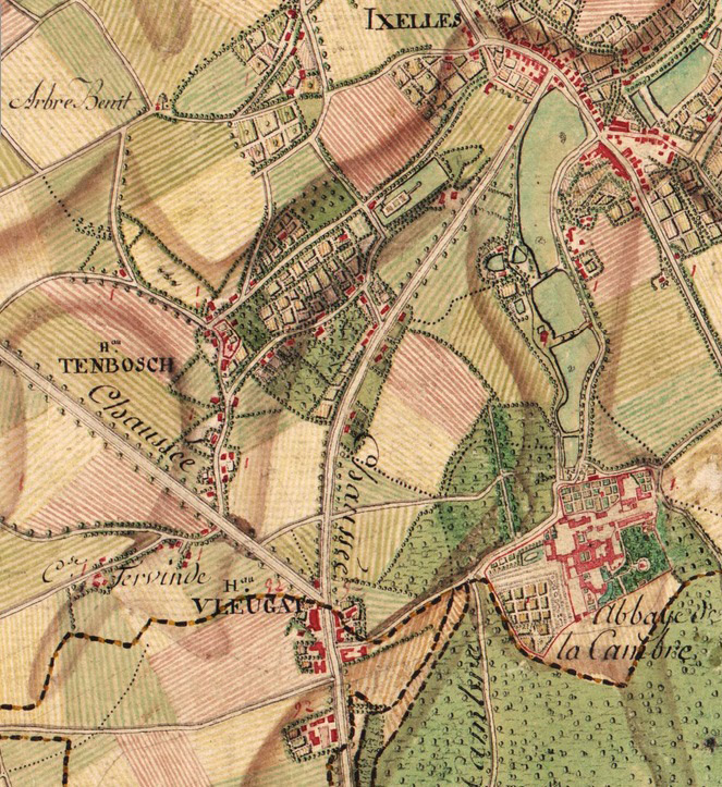
Map of Ixelles, Belgium in the 17th Century (7/40)
Search Gallery:

Map of Ixelles, Belgium in the 17th Century (7/40)

Free Photos > Belgium Photos > Other Photos > Map of Ixelles, Belgium in the 17th Century (7/40)

To view or save this photo in High resolution, just click the photo to see the full image(the full image is much higher quality and not pixelated).

Map of Ixelles, Belgium in the 17th Century. Photo by Comte de Ferraris.

All free photos on this site are public domain. Please consider giving a credit hyperlink to https://www.goodfreephotos.com if you use the photos on this site using the attribution code in the below box. It is not required but it'd be much appreciated.

This photo is under the CC0 / Public Domain License.

Sponsored Images via Shutterstock:
Black and white urban map of Ixelles Belgium.This map contains geographic lines for main and secondary roads.
Dark blue urban map of Ixelles Belgium.This map contains geographic lines for main and secondary roads.
Purple map of Ixelles Belgium.
Detailed hand-drawn navigational urban street roads map of the ILOT SACRE DISTRICT of the Belgian city of BRUSSELS, Belgium with vivid road lines and name tag on solid background
Map of the Southern Netherlands, Jan Luyken (possibly), 1696 - 1701 Map of the Southern Netherlands, with a cartouche below the center with the title and publisher
The island of Gekskop, vintage engraving.
Coupon Code: GFP15 for 15% off


Similar Images
Louvain-la-Neuve Science Park in Ottignies in Belgium Pines at Knocke landscape at Knokke-Heist, Belgium Ypres's shell-blasted Cloth Hall burns in Belgium Ruins of Ypres after World War II in Belgium Panormanic View of the Beach in Ostend, Belgium The second castle of Kortrijk, Belgium Map of  Ixelles, Belgium in the 17th Century The Burg in Bruges around 1695 in Belgium Foggy and Swampy Landscape in Belgium Misty boardwalk through the swamp in Belgium Kiddie Ride at Abandoned Amusement Park in Dadizele, Belgium Small abandoned house in Dadipark, Dadizele, Belgium Pyramid overlooking Waterloo, Belgium Landscape and highway near Houyet, Belgium Flag of Belgium Golden Sculpture overlooking Namur, Belgium Painting of one time village in Knokke-Heist, Belgium Mill by Champaign channel in Belgium The Church of Saint Lambert, Nossegem, Zaventem, Brussels Main road between Brussels and Leuven in Nossegem , Zaventem, Belgium The Church of Saint Pancras, Sterrebeek in Zaventem, Belgium Place des Carabiniers in Schaerbeek, Belgium Avenue Jean Van Hoorenbeeck in Auderghem, Belgium Belgian Revolution of 1830 in Belgium Brewery Het Anker, home of the Gouden Carolus beer in Mechelen, Belgium German World War I military cemetery in Menen, Belgium The City Theatre in Kortrijk, Belgium Exterior of the Boudewijn Seapark dolphinarium in Bruges, Belgium Monument to Charlemagne in Herstal, Belgium Jette Railway Station in Belgium Albert Canal at Sunset near Hasselt, Belgium Old streets in the Béguinage in Kortrijk, Belgium Geel train station in Belgium Museumship, the barquentine Mercator in Ostend, Belgium The Peperbusse Church in Ostend, Belgium Promenade at Ostend seaside in Belgium Pier and beach in Ostend, Belgium Fonske Statue in Leuven, Belgium Aerial view over one of Bruges' canals in Belgium Casino Kursaal in Ostend in Belgium

Sponsored Footage via Shutterstock:
Detailed view of an illustration of the sun at the left of the screen into a modern printed reproduction of a 17th century world map
Animated map footage showing Belgium
Classic antique map Europe continent detailed historical cartographic illustration
Detailed view of a modern printed reproduction of a 17th century antique world map showing the allegorical representation of the earth element.
Stylized map illustration with vibrant colors and location markers
Belgium Map Highlight with Animated Flag Pin on World Satellite Map


Free Photos > Belgium Photos > Other Photos > Map of Ixelles, Belgium in the 17th Century (7/40)

To view or save this photo in High resolution, just click the photo to see the full image(the full image is much higher quality and not pixelated).

Map of Ixelles, Belgium in the 17th Century. Photo by Comte de Ferraris.

All free photos on this site are public domain. Please consider giving a credit hyperlink to https://www.goodfreephotos.com if you use the photos on this site using the attribution code in the below box. It is not required but it'd be much appreciated.

This photo is under the CC0 / Public Domain License.