Search Gallery:
ABERT RIM PANORAMIC-FREMONT WINEMA (74/126)
ABERT RIM PANORAMIC-FREMONT WINEMA (74/126)
Search Gallery:
ABERT RIM PANORAMIC-FREMONT WINEMA (74/126)
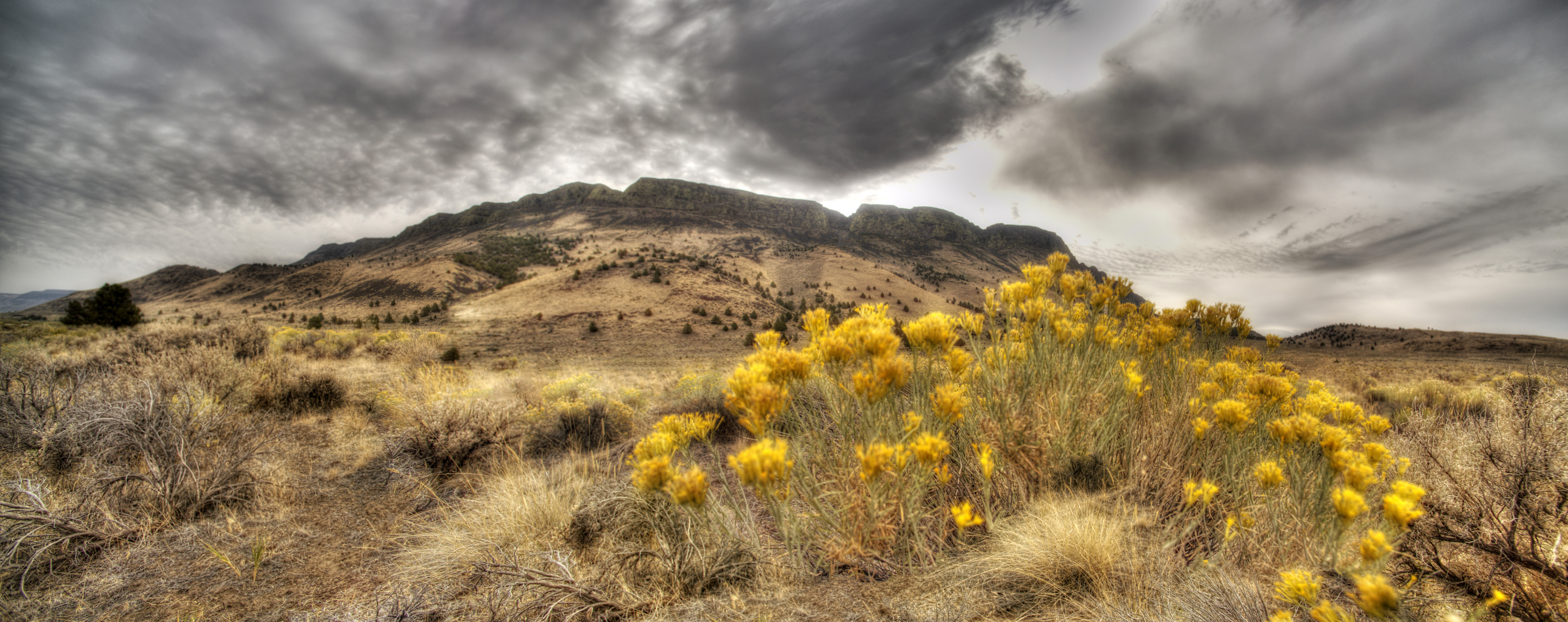
Free Photos > USA Photos > Oregon Photos > Other Oregon Photos > ABERT RIM PANORAMIC-FREMONT WINEMA (74/126) Abert Rim in Lake County, Oregon is one of the highest fault scarps in the United States. It rises 2500 ft above the valley floor, finishing with an 800 ft sheer-sided basalt cap. It was formed during the Miocene epoch. At that time basaltic flood lavas covered much of eastern Oregon. In subsequent faulting, great blocks were tilted and Abert Rim is at the western end of one of these blocks, while Lake Abert lies on top of another. Stretching more than 30 miles from Lakeview north to Alkali Lake, Abert Rim is also the longest exposed fault scarp in North America. U.S. Forest Service- Pacific Northwest Region. Bighorn sheep were transplanted to the rim in 1975 and 1977 from nearby Hart Mountain, and are often spotted from the Abert Rim geologic point of interest sign located along Highway 395. Raptors, such as the Ferruginous Hawk, are also common in the area. The Chewaucan River enters the lake from the south, however it has no outlet. The lake level varies depending on rainfall and it nearly completely dried up 140 years ago. It is one of the Great Basin lakes. The escarpment and lake were first mapped on December 20, 1843 by John C. Frémont who named it after Colonel John James Abert, his commanding officer. Elevation 7,548 ft Prominence 2,500 ft Lake County, Oregon, USA Coordinates 42°23â²18â³N 120°14â²05â³WCoordinates: 42°23â²18â³N 120°14â²05â³W All free photos on this site are public domain. Please consider giving a credit hyperlink to https://www.goodfreephotos.com if you use the photos on this site using the attribution code in the below box. It is not required but it'd be much appreciated.
|
| ||||||||||||||||||||||||||||||||||||||||||||||||||
© Copyright 2024 Free Photos - Free Images. All rights reserved. Designed by CreativeMug | Zenphoto


